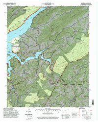
1994 Map of Elk Mills
USGS Topo · Published 1998About this map
Watauga Lake dominates this mountain landscape, its northern reaches defined by the Watauga Reservation Boundary and the high peaks of Sink Mountain. The region is a dense network of family-named hollows and ridges, such as Duncan Hollow and Meat Camp Hollow, where the Forest Service revised these records in the mid-1990s. Remote settlements like Buntontown, Peoria, and Elk Mills are tied together by a web of rural churches and cemeteries, including the Sink Valley Church and Grindstaff Cemetery.
Find a feature on this map
96 named features on this map. Tap any name to fly to it.
Don’t see what you’re looking for? This feature index may not catch every label — zoom into the map to look around manually.
Map Details
Editions of this 1994 Elk Mills Map
This is the sole edition of this map. No revisions or reprints were ever made.
Other maps of this area

1891 · Roan Mountain
USGS Topo · 1:125,000

1893 · Cranberry
USGS Topo · 1:125,000

1894 · Roan Mountain
USGS Topo · 1:125,000

1895 · Cranberry
USGS Topo · 1:125,000

1899 · Cranberry
USGS Topo · 1:125,000

1902 · Cranberry
USGS Topo · 1:125,000

1904 · Roan Mountain
USGS Topo · 1:125,000

1934 · Valle Crucis
USGS Topo · 1:24,000

1934 · White Rocks Mtn
USGS Topo · 1:24,000

1934 · Elk Park
USGS Topo · 1:24,000