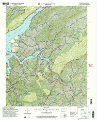
2003 Map of Elk Mills
USGS Topo · Published 2004About this map
Watauga Lake serves as a central hub for the rugged borders of Tennessee and North Carolina, where the Roan Creek and Watauga River arms meet. This terrain is defined by steep ridges like Gipson Mountain and Sink Mountain, punctuated by numerous family-named burial grounds and rural institutions that speak to the area's deep-rooted settlement history. Facilities such as the Sink Mountain Boating Site and Gregg Boat Dock indicate the region's development as a recreational destination within the Cherokee National Forest.
Find a feature on this map
100 named features on this map. Tap any name to fly to it.
Don’t see what you’re looking for? This feature index may not catch every label — zoom into the map to look around manually.
Map Details
Editions of this 2003 Elk Mills Map
This is the sole edition of this map. No revisions or reprints were ever made.
Other maps of this area

1891 · Roan Mountain
USGS Topo · 1:125,000

1893 · Cranberry
USGS Topo · 1:125,000

1894 · Roan Mountain
USGS Topo · 1:125,000

1895 · Cranberry
USGS Topo · 1:125,000

1899 · Cranberry
USGS Topo · 1:125,000

1902 · Cranberry
USGS Topo · 1:125,000

1904 · Roan Mountain
USGS Topo · 1:125,000

1934 · Valle Crucis
USGS Topo · 1:24,000

1934 · White Rocks Mtn
USGS Topo · 1:24,000

1934 · Elk Park
USGS Topo · 1:24,000