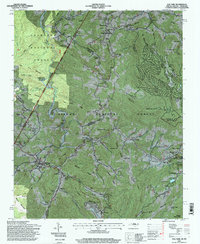
1994 Map of Elk Park
USGS Topo · Published 1998About this map
Beech Mountain and the high ridges of the Blue Ridge dominate this mid-1990s survey of the North Carolina-Tennessee border. The industrial and educational character of Avery County is evident in the transition from the legacy of the Cranberry Mines and the Tennessee North Carolina railroad corridor to the growing campus of Lees-McRae College in Banner Elk. Numerous family cemeteries, such as the McGuire Cemetery and Harmon Cemetery, are scattered across the slopes, documenting the deep genealogical roots of these mountain hollows. The landscape is defined by its steep geography, where settlements like Heaton and Elk Valley follow the narrow river valleys. Notable landmarks include the Grandfather Home for Children and the high-elevation Beech Mountain Airfield, alongside more traditional sites like the Farmon Mill on the Watauga River.
Find a feature on this map
110 named features on this map. Tap any name to fly to it.
Don’t see what you’re looking for? This feature index may not catch every label — zoom into the map to look around manually.
Map Details
Editions of this 1994 Elk Park Map
This is the sole edition of this map. No revisions or reprints were ever made.
Other maps of this area

1891 · Roan Mountain
USGS Topo · 1:125,000

1893 · Cranberry
USGS Topo · 1:125,000

1894 · Roan Mountain
USGS Topo · 1:125,000

1895 · Cranberry
USGS Topo · 1:125,000

1899 · Cranberry
USGS Topo · 1:125,000

1902 · Cranberry
USGS Topo · 1:125,000

1904 · Roan Mountain
USGS Topo · 1:125,000

1934 · Valle Crucis
USGS Topo · 1:24,000

1934 · White Rocks Mtn
USGS Topo · 1:24,000

1934 · Elk Park
USGS Topo · 1:24,000