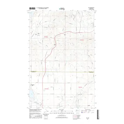
2017 Map of Elk
USGS Topo · Published 2017About this map
The Little Spokane River winds through this 2017 study of the northeastern corner of Spokane County, centered on the community of Elk. The landscape is defined by the transition from the valley floors, where Eloika Lake and Pocahontas Bay sit, to the rising timbered ridges of Bare Mtn and Rogers Pass. A distinct rural network of family-named roads like Jermain Rd and Taylor Rd connects residential pockets such as Shadow Valley and Camp Joubert with the Elk Heights Airport. The map also captures the political boundary where the county line separates Spokane from Pend Oreille to the north. This modern survey provides a clear view of the water system, including Otter Cr and Reflection Lake, alongside the established township and range grids that continue to organize this part of Washington.
Find a feature on this map
117 named features on this map. Tap any name to fly to it.
Don’t see what you’re looking for? This feature index may not catch every label — zoom into the map to look around manually.
Map Details
Editions of this 2017 Elk Map
This is the sole edition of this map. No revisions or reprints were ever made.
Other maps of this area

1901 · Spokane
USGS Topo · 1:125,000

1936 · Newport
USGS Topo · 1:96,000

1942 · Newport
USGS Topo · 1:125,000

1943 · Mt Spokane
USGS Topo · 1:62,500

1949 · Deer Park
USGS Topo · 1:62,500

1950 · Mt Spokane
USGS Topo · 1:62,500

1951 · Deer Park
USGS Topo · 1:62,500

1955 · Spokane
USGS Topo · 1:250,000

1958 · Spokane
USGS Topo · 1:250,000

1958 · Sandpoint
USGS Topo · 1:250,000