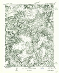
1954 Map of Elk Ridge 2 SW
USGS Topo · Published 1954About this map
Dark Canyon Plateau dominates this mid-century topographic survey, revealing a landscape defined by deeply incised drainages within the Manti-La Sal National Forest. The map is a preliminary edition, compiled from 1952 aerial photography to document the high-altitude terrain of San Juan County before more comprehensive 15-minute maps were finalized. Significant geological features include the massive Woodenshoe Canyon and Dark Canyon, which showcase the complex erosional patterns of the region.
Find a feature on this map
11 named features on this map. Tap any name to fly to it.
Don’t see what you’re looking for? This feature index may not catch every label — zoom into the map to look around manually.
Map Details
Editions of this 1954 Elk Ridge 2 SW Map
This is the sole edition of this map. No revisions or reprints were ever made.
Other maps of this area

1886 · Henry Mountains
USGS Topo · 1:250,000

1886 · Abajo
USGS Topo · 1:250,000

1892 · Abajo
USGS Topo · 1:250,000

1892 · Henry Mountains
USGS Topo · 1:250,000

1893 · Abajo
USGS Topo · 1:250,000

1935 · Elk Ridge
USGS Topo · 1:96,000

1940 · Elk Ridge
USGS Topo · 1:125,000

1952 · Mouth of Dark Canyon
USGS Topo · 1:62,500

1952 · Natural Bridges
USGS Topo · 1:62,500
1954 · White Canyon 1 NE
USGS Topo · 1:24,000