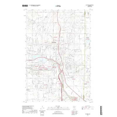
2019 Map of Elk River
USGS Topo · Published 2019About this map
The Mississippi River defines the southern boundary of this region, where the urban expansion of Elk River meets the rural landscapes of Otsego and Ramsey. The confluence of the Elk River and the Mississippi serves as a geographic anchor, creating a complex hydrologic network that includes Orono Lake and various smaller basins like Little Twin Lake. This 2019 survey documents a landscape in transition, where residential development along US Hwy 169 sits alongside significant genealogical landmarks. Several local burial sites are noted, including the Saint Andrew's Cem and the distinctly named Farm of Ernest Rahn Cem. To the north, the Meadowvale Airport and the settlement of Nowthen highlight the area's continued use as a transport and residential hub at the intersection of Sherburne and Anoka counties.
Find a feature on this map
31 named features on this map. Tap any name to fly to it.
Don’t see what you’re looking for? This feature index may not catch every label — zoom into the map to look around manually.
Map Details
Editions of this 2019 Elk River Map
This is the sole edition of this map. No revisions or reprints were ever made.
Other maps of this area

1902 · Anoka
USGS Topo · 1:62,500

1909 · Rockford
USGS Topo · 1:62,500

1916 · St. Francis
USGS Topo · 1:62,500

1919 · St. Francis
USGS Topo · 1:62,500

1953 · Stillwater
USGS Topo · 1:250,000

1955 · Anoka
USGS Topo · 1:24,000

1955 · Anoka
USGS Topo · 1:62,500

1955 · Stillwater
USGS Topo · 1:250,000

1958 · Stillwater
USGS Topo · 1:250,000

1958 · Rockford
USGS Topo · 1:62,500