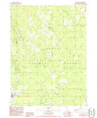
1986 Map of Elk Spring
USGS Topo · Published 1986About this map
Shasta National Forest dominates this landscape in Siskiyou County, where water resources define the topography. The presence of several named springs, including Elk Spring, Widow Spring, and Esperanza Spring, highlights the critical role of groundwater in this part of California. The terrain transitions through Squaw Valley and past the distinctive Red Hill, with Ash Creek and Mud Creek draining the forest slopes. Human engineering is evident in the water management systems, notably the Aqueduct and Ditch infrastructure. In the southern portion of the quadrangle, a Landing Strip and a Transmission Line suggest the modest industrial and logistical footprint in this largely natural expanse. This 1980s provisional map serves as a detailed record of high-country resource management and the physical geography of the Siskiyou region.
Find a feature on this map
18 named features on this map. Tap any name to fly to it.
Don’t see what you’re looking for? This feature index may not catch every label — zoom into the map to look around manually.
Map Details
Editions of this 1986 Elk Spring Map
This is the sole edition of this map. No revisions or reprints were ever made.
Other maps of this area

1886 · Modoc Lava Bed
USGS Topo · 1:250,000

1886 · Shasta
USGS Topo · 1:250,000

1892 · Modoc Lava-Bed
USGS Topo · 1:250,000

1894 · Shasta
USGS Topo · 1:250,000

1932 · Bartle
USGS Topo · 1:96,000

1935 · Dunsmuir
USGS Topo · 1:125,000

1939 · Bartle
USGS Topo · 1:125,000

1948 · Weed
USGS Topo · 1:250,000

1950 · Weed
USGS Topo · 1:250,000

1954 · Shoeinhorse Mountain
USGS Topo · 1:62,500