
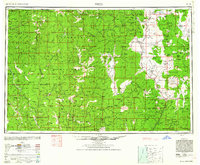
1948 Map of Weed
USGS Topo · Published 1950About this map
Siskiyou County serves as the focal point for this mid-century topographic record, where the converging Klamath and Cascade Range create a complex landscape of deep river canyons and high basins. The Klamath River dominates the northern and western sections, joined by tributaries like the Scott River and Salmon River that supported remote mining outposts such as Scott Bar and the Classic Hill Mine. In the east, the Shasta Valley provides a stark contrast, centered around the rail hub of Weed and the agricultural settlements of Grenada and Montague.
Find a feature on this map
187 named features on this map. Tap any name to fly to it.
Don’t see what you’re looking for? This feature index may not catch every label — zoom into the map to look around manually.
Map Details
Editions of this 1948 Weed Map
2 editions found
Other maps of this area

1886 · Lassen Peak
USGS Topo · 1:250,000

1886 · Modoc Lava Bed
USGS Topo · 1:250,000

1886 · Shasta
USGS Topo · 1:250,000

1889 · Klamath
USGS Topo · 1:250,000

1890 · Red Bluff
USGS Topo · 1:250,000

1891 · Ashland
USGS Topo · 1:250,000

1892 · Modoc Lava-Bed
USGS Topo · 1:250,000

1892 · Lassen Peak
USGS Topo · 1:250,000

1893 · Ashland
USGS Topo · 1:250,000

1894 · Lassen Peak
USGS Topo · 1:250,000