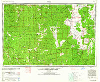
1948 Map of Weed
USGS Topo · Published 1962About this map
Mt Shasta towers over this mid-century landscape, anchoring a region defined by the intersection of the Siskiyou Mountains and the volcanic Medicine Lake Highland. The map documents a rugged timber and mining economy, where the Southern Pacific RR and Us 99 navigate the Shasta Valley to connect towns like Weed and Yreka. To the west, the winding Klamath River and Salmon River cut through dense forests, supporting isolated settlements such as Happy Camp and Sawyers Bar.
Find a feature on this map
98 named features on this map. Tap any name to fly to it.
Don’t see what you’re looking for? This feature index may not catch every label — zoom into the map to look around manually.
Map Details
Editions of this 1948 Weed Map
2 editions found

Other maps of this area

1886 · Lassen Peak
USGS Topo · 1:250,000

1886 · Modoc Lava Bed
USGS Topo · 1:250,000

1886 · Shasta
USGS Topo · 1:250,000

1889 · Klamath
USGS Topo · 1:250,000

1890 · Red Bluff
USGS Topo · 1:250,000

1891 · Ashland
USGS Topo · 1:250,000

1892 · Modoc Lava-Bed
USGS Topo · 1:250,000

1892 · Lassen Peak
USGS Topo · 1:250,000

1893 · Ashland
USGS Topo · 1:250,000

1894 · Lassen Peak
USGS Topo · 1:250,000