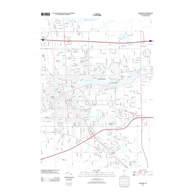
2013 Map of Elkhart
USGS Topo · Published 2013About this map
The confluence of the Saint Joseph River and the Elkhart River anchors this 2013 survey of Elkhart and its surrounding residential developments. The urban core gives way to several distinct communities and neighborhoods such as Greenleaf Manor, Garden Village, and De Camp Gardens, illustrating the suburban character of the region in the early 21st century. To the south, the settlement of Dunlap is clearly defined along the arterial roads leading toward the Elkhart County Landfill.
Find a feature on this map
42 named features on this map. Tap any name to fly to it.
Don’t see what you’re looking for? This feature index may not catch every label — zoom into the map to look around manually.
Map Details
Editions of this 2013 Elkhart Map
This is the sole edition of this map. No revisions or reprints were ever made.
Other maps of this area

1945 · Cassopolis
USGS Topo · 1:62,500

1947 · Cassopolis
USGS Topo · 1:62,500

1948 · Vandalia
USGS Topo · 1:62,500

1949 · Vandalia
USGS Topo · 1:62,500

1953 · Fort Wayne
USGS Topo · 1:250,000

1953 · Chicago
USGS Topo · 1:250,000

1956 · Fort Wayne
USGS Topo · 1:250,000

1957 · Chicago
USGS Topo · 1:250,000

1958 · Osceola
USGS Topo · 1:24,000

1959 · Goshen
USGS Topo · 1:24,000