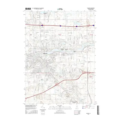
2016 Map of Elkhart
USGS Topo · Published 2016About this map
The Saint Joseph River and Elkhart River converge at the heart of this mid-2010s survey, defining the industrial and residential corridors of Elkhart. The landscape reveals a complex network of historic transit and modern development, where the Norfolk Southern Railway skirts the southern urban edge near Dunlap and Goshen. This era shows significant suburban expansion around northern water bodies like Simonton Lake and Heaton Lake, as well as established neighborhoods such as Greenleaf Manor and Garden Village. Local history is anchored by several long-standing burial grounds, including Rice Cem and Grace Lawn Cem. The presence of the Associated Mennonite Biblical Seminary and the Harrison Coll Elkhart Campus underscores the region's role as a center for education and theology. To the west, the Elkhart Municipal Airport serves as a prominent landmark of the city's modern infrastructure.
Find a feature on this map
151 named features on this map. Tap any name to fly to it.
Don’t see what you’re looking for? This feature index may not catch every label — zoom into the map to look around manually.
Map Details
Editions of this 2016 Elkhart Map
This is the sole edition of this map. No revisions or reprints were ever made.
Other maps of this area

1945 · Cassopolis
USGS Topo · 1:62,500

1947 · Cassopolis
USGS Topo · 1:62,500

1948 · Vandalia
USGS Topo · 1:62,500

1949 · Vandalia
USGS Topo · 1:62,500

1953 · Fort Wayne
USGS Topo · 1:250,000

1953 · Chicago
USGS Topo · 1:250,000

1956 · Fort Wayne
USGS Topo · 1:250,000

1957 · Chicago
USGS Topo · 1:250,000

1958 · Osceola
USGS Topo · 1:24,000

1959 · Goshen
USGS Topo · 1:24,000