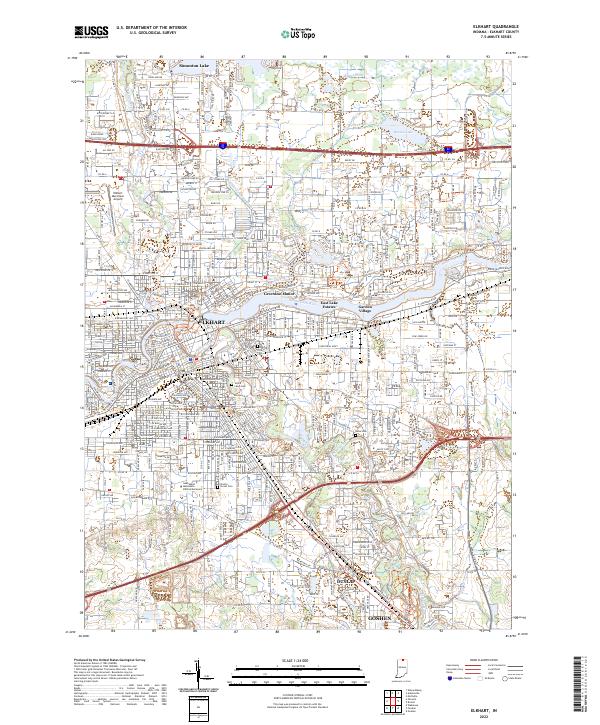
2022 Map of Elkhart
USGS Topo · Published 2022About this map
The Saint Joseph River and Elkhart River converge at the heart of this Indiana industrial and residential hub, anchoring a landscape shaped by water and transit. This 2022 survey documents the urbanized corridor stretching from Elkhart south toward Dunlap and the northern edge of Goshen. The map captures the significant educational and religious presence of the Anabaptist Mennonite Biblical Seminary and numerous historical burial grounds including Rice Cem and Grace Lawn Cem.
Find a feature on this map
55 named features on this map. Tap any name to fly to it.
Don’t see what you’re looking for? This feature index may not catch every label — zoom into the map to look around manually.
Map Details
Editions of this 2022 Elkhart Map
This is the sole edition of this map. No revisions or reprints were ever made.
Other maps of this area

1945 · Cassopolis
USGS Topo · 1:62,500

1947 · Cassopolis
USGS Topo · 1:62,500

1948 · Vandalia
USGS Topo · 1:62,500

1949 · Vandalia
USGS Topo · 1:62,500

1953 · Fort Wayne
USGS Topo · 1:250,000

1953 · Chicago
USGS Topo · 1:250,000

1956 · Fort Wayne
USGS Topo · 1:250,000

1957 · Chicago
USGS Topo · 1:250,000

1958 · Osceola
USGS Topo · 1:24,000

1959 · Goshen
USGS Topo · 1:24,000