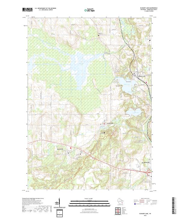
2022 Map of Elkhart Lake
USGS Topo · Published 2022About this map
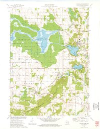
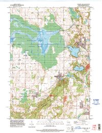
Elkhart Lake serves as a central hub in this section of Sheboygan County, where the glacial landscape is defined by features like Esker Ridge and Hickory Hill. The terrain is deeply marked by a complex hydrological network, including the expansive Sheboygan Lake and a series of managed waterways like Main Ditch, North Ditch, and Bergin Ditch. These drainage systems reflect long-standing efforts to manage the low-lying wetlands surrounding the Sheboygan River. To the south, Glenbeulah and Greenbush anchor the local community, which is dotted with several historic burial grounds including Saint Fridolin Cem and Walnut Grove Cem. The area around Crystal Lake and Otter Pond shows a transition from the agricultural lowlands to the more wooded, kettle-and-moraine topography that characterizes this part of Wisconsin. This map provides a detailed view of the interaction between the area's prominent water bodies and the rural road network connecting these historic settlements.
Find a feature on this map
98 named features on this map. Tap any name to fly to it.
Don’t see what you’re looking for? This feature index may not catch every label — zoom into the map to look around manually.
Map Details
Editions of this 2022 Elkhart Lake Map
This is the sole edition of this map. No revisions or reprints were ever made.
Historical Maps of Plymouth Through Time
3 maps found