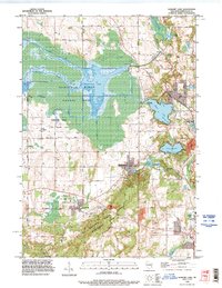
1992 Map of Elkhart Lake
USGS Topo · Published 1996About this map
The Sheboygan Marsh and the Kettle Moraine State Forest Northern Unit dominate the landscape of northwestern Sheboygan County, reflecting a complex glacial topography. Much of the western half of the sheet is dedicated to the Sheboygan Marsh State Wildlife Area, where the Sheboygan River feeds into Sheboygan Lake. This 1990s revision captures the area’s distinct balance between conservation land and long-standing settlements like Elkhart Lake and Glenbeulah.
Find a feature on this map
43 named features on this map. Tap any name to fly to it.
Don’t see what you’re looking for? This feature index may not catch every label — zoom into the map to look around manually.
Map Details
Editions of this 1992 Elkhart Lake Map
This is the sole edition of this map. No revisions or reprints were ever made.
Other maps of this area

1954 · Sheboygan Falls
USGS Topo · 1:62,500

1954 · School Hill
USGS Topo · 1:24,000

1954 · Howards Grove
USGS Topo · 1:62,500

1954 · Franklin
USGS Topo · 1:24,000

1954 · Kiel
USGS Topo · 1:62,500

1954 · Milwaukee
USGS Topo · 1:250,000

1955 · Kewaskum
USGS Topo · 1:62,500

1957 · Madison
USGS Topo · 1:250,000

1958 · Milwaukee
USGS Topo · 1:250,000

1960 · Madison
USGS Topo · 1:250,000