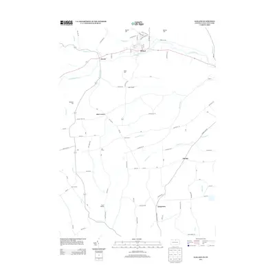
2013 Map of Elkland
USGS Topo · Published 2013About this map
The Cowanesque River valley anchors this 2013 survey of the Pennsylvania-New York border, where the industrial and residential grid of Elkland sits just north of the water. The landscape transitions from the river flats into a series of named ridges and hollows, including Mutton Hill, Barney Hill, and Croft Hollow. Small rural crossroads like Odle Corners, Karls Corners, and Elbridge connect the upland farms to the larger river settlements. Near the center of the sheet, Baker Airport serves as a modern landmark among the traditional dairy and agricultural lands. The map detail reflects a region defined by its narrow valley bottoms and steep hillsides, with waterways like Thornbottom Cr and Cummings Cr cutting through the terrain to join the main river course.
Find a feature on this map
90 named features on this map. Tap any name to fly to it.
Don’t see what you’re looking for? This feature index may not catch every label — zoom into the map to look around manually.
Map Details
Editions of this 2013 Elkland Map
This is the sole edition of this map. No revisions or reprints were ever made.
Other maps of this area

1900 · Tioga
USGS Topo · 1:62,500

1900 · Elkland
USGS Topo · 1:62,500

1902 · Tioga
USGS Topo · 1:62,500

1914 · Corning
USGS Topo · 1:62,500

1924 · Woodhull
USGS Topo · 1:48,000

1926 · Woodhull
USGS Topo · 1:62,500

1944 · Woodhull
USGS Topo · 1:62,500

1944 · Corning
USGS Topo · 1:62,500

1950 · Elmira
USGS Topo · 1:250,000

1953 · Woodhull
USGS Topo · 1:24,000