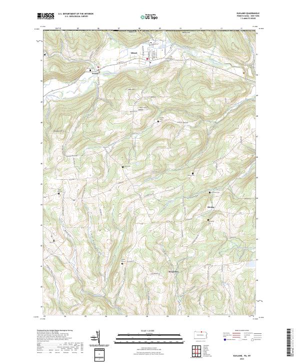
2023 Map of Elkland
USGS Topo · Published 2023About this map
The Cowanesque River corridor anchors this northern Tioga County landscape, where the concentrated street grids of Elkland and Osceola give way to the dissected plateaus of the Southern Tier. Rising above the river valley, the terrain is marked by prominent heights like Mutton Hill and Barney Hill, separated by deep drainage paths such as Croft Hollow. The map reveals a dispersed rural pattern of family-named landmarks and upland burial grounds, including the Gee Family Cem and Mourey Cem. Small aviation infrastructure appears at Baker Airport, while various watercourses like Thornbottom Creek and Cummings Creek have carved the topography into a series of ridges and valleys. This 2023 survey documents the contemporary road network, from W Main St in the urban centers to winding routes like Tannery Hill Rd and Pleasant Valley Rd that navigate the high country.
Find a feature on this map
87 named features on this map. Tap any name to fly to it.
Don’t see what you’re looking for? This feature index may not catch every label — zoom into the map to look around manually.
Map Details
Editions of this 2023 Elkland Map
This is the sole edition of this map. No revisions or reprints were ever made.
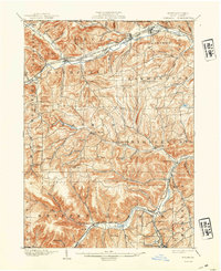
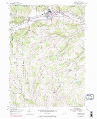
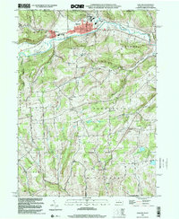
Historical Maps of Farmington Township Through Time
4 maps found