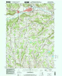
1999 Map of Elkland
USGS Topo · Published 2001About this map
The Cowanesque River flows through the northern reaches of this Tioga County landscape, defining the valley where the boroughs of Elkland and Osceola are established. Just south of the New York state line, the area transitions from the river valley floor up into the highlands of Deerfield and Farmington townships. Evidence of local industry and infrastructure is visible in the network of pipelines crossing the terrain and a Gravel Pit near Nelson.
Find a feature on this map
43 named features on this map. Tap any name to fly to it.
Don’t see what you’re looking for? This feature index may not catch every label — zoom into the map to look around manually.
Map Details
Editions of this 1999 Elkland Map
This is the sole edition of this map. No revisions or reprints were ever made.
Other maps of this area

1900 · Tioga
USGS Topo · 1:62,500

1900 · Elkland
USGS Topo · 1:62,500

1902 · Tioga
USGS Topo · 1:62,500

1914 · Corning
USGS Topo · 1:62,500

1924 · Woodhull
USGS Topo · 1:48,000

1926 · Woodhull
USGS Topo · 1:62,500

1944 · Woodhull
USGS Topo · 1:62,500

1944 · Corning
USGS Topo · 1:62,500

1950 · Elmira
USGS Topo · 1:250,000

1953 · Woodhull
USGS Topo · 1:24,000