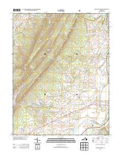
2013 Map of Elkton West
USGS Topo · Published 2013About this map
The S Fork Shenandoah River meanders through the eastern corridor of this landscape, defining the agricultural and residential development around Greenwood and East Point. The river's path is mirrored by the Norfolk Southern railroad, which services the area's industrial and logistical needs near Elkton. To the west, the terrain rises sharply into the ridgelines of First Mountain and Second Mountain, where gaps like Fridley Gap and Runkles Gap provide natural passage through the high ground.
Find a feature on this map
150 named features on this map. Tap any name to fly to it.
Don’t see what you’re looking for? This feature index may not catch every label — zoom into the map to look around manually.
Map Details
Editions of this 2013 Elkton West Map
This is the sole edition of this map. No revisions or reprints were ever made.
Other maps of this area

1892 · Woodstock
USGS Topo · 1:125,000

1892 · Harrisonburg
USGS Topo · 1:125,000

1937 · Elkton
USGS Topo · 1:62,500

1941 · Harrisonburg
USGS Topo · 1:62,500

1942 · Mt Jackson
USGS Topo · 1:62,500

1943 · Harrisonburg
USGS Topo · 1:62,500

1946 · Mt Jackson
USGS Topo · 1:62,500

1947 · Mt Jackson
USGS Topo · 1:62,500

1947 · Broadway
USGS Topo · 1:62,500

1949 · Charlottesville
USGS Topo · 1:250,000