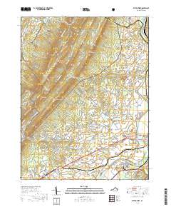
2019 Map of Elkton West
USGS Topo · Published 2019About this map
The South Fork Shenandoah River winds through the heart of the Page Valley, defining the topography between the prominent ridges of the George Washington National Forest and the valley floor. This 2019 survey captures the developed corridor along the Norfolk Southern railroad, where the communities of Elkton, Solsburg, and Shenandoah are situated. The map provides significant detail for genealogists, documenting the location of the East Point Cem and Bethel Church, alongside long-established settlements like McGaheysville and East Point.
Find a feature on this map
153 named features on this map. Tap any name to fly to it.
Don’t see what you’re looking for? This feature index may not catch every label — zoom into the map to look around manually.
Map Details
Editions of this 2019 Elkton West Map
This is the sole edition of this map. No revisions or reprints were ever made.
Other maps of this area

1892 · Woodstock
USGS Topo · 1:125,000

1892 · Harrisonburg
USGS Topo · 1:125,000

1937 · Elkton
USGS Topo · 1:62,500

1941 · Harrisonburg
USGS Topo · 1:62,500

1942 · Mt Jackson
USGS Topo · 1:62,500

1943 · Harrisonburg
USGS Topo · 1:62,500

1946 · Mt Jackson
USGS Topo · 1:62,500

1947 · Mt Jackson
USGS Topo · 1:62,500

1947 · Broadway
USGS Topo · 1:62,500

1949 · Charlottesville
USGS Topo · 1:250,000