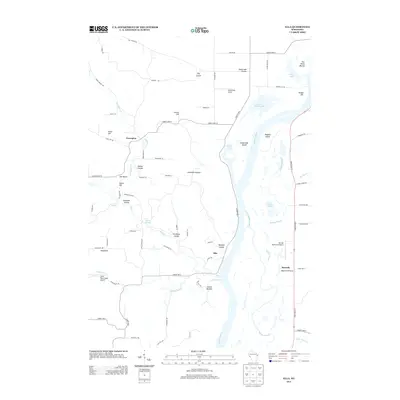
2013 Map of Ella
USGS Topo · Published 2013About this map
Chippewa River floodplains and the high bluffs of western Wisconsin dominate this landscape, where the river's path is marked by complex water features like Little Buffalo Slough, Stump Lake, and Buffalo Island. The small settlement of Ella sits at the foot of the bluffs near Bearpen Coulee, while the upland terrain is carved by numerous namesake coulees including Patten Coulee and Paradise Coulee. This 2013 survey illustrates the persistence of small rural communities and the area's transition into an aviation-rich corridor, featuring multiple landing strips such as Rutherford Airport, Durand Municipal Airport, and the Little Plum Creek Airport. To the east, the flat expanse of Maxville Prairie and the community of Maxville highlight the contrast between the river bottomlands and the agricultural plateaus typical of this region of Buffalo Slough.
Find a feature on this map
80 named features on this map. Tap any name to fly to it.
Don’t see what you’re looking for? This feature index may not catch every label — zoom into the map to look around manually.
Map Details
Editions of this 2013 Ella Map
This is the sole edition of this map. No revisions or reprints were ever made.
Other maps of this area

1929 · Durand
USGS Topo · 1:62,500

1932 · Wabasha
USGS Topo · 1:62,500

1932 · Durand
USGS Topo · 1:62,500

1932 · Alma
USGS Topo · 1:62,500

1935 · Arkansaw
USGS Topo · 1:48,000

1941 · Arkansaw
USGS Topo · 1:62,500

1942 · Arkansaw
USGS Topo · 1:62,500

1950 · Alma
USGS Topo · 1:62,500

1951 · Wabasha
USGS Topo · 1:62,500

1953 · Saint Paul
USGS Topo · 1:250,000