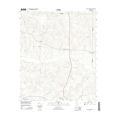
2014 Map of Ellaville North
USGS Topo · Published 2014About this map
Ellaville serves as the southern anchor for this portion of Schley County, where local roads branch northward through a landscape defined by creeks and family-owned millponds. The map reveals a network of rural settlements like Concord and Murrays Crossroads, positioned at the junction of US Highway 19 N and E Ga-240. The terrain is significantly shaped by water management and recreation, evidenced by numerous named impoundments such as Hills Millpond, Brays Mill Pond, and the paired Rufus Peepe Lake N and Rufus Peepe Lake S. These features suggest a local history tied to small-scale milling and private land development. The distribution of properties is further marked by legacy naming, with landmarks like Wells Lake and Owens Lake providing specific points of interest for those researching family history or historical land use patterns in this part of Georgia.
Find a feature on this map
65 named features on this map. Tap any name to fly to it.
Don’t see what you’re looking for? This feature index may not catch every label — zoom into the map to look around manually.
Map Details
Editions of this 2014 Ellaville North Map
This is the sole edition of this map. No revisions or reprints were ever made.
Other maps of this area

1955 · Phenix City
USGS Topo · 1:250,000

1957 · Phenix City
USGS Topo · 1:250,000

1958 · Phenix City
USGS Topo · 1:250,000

1971 · Rupert
USGS Topo · 1:24,000

1971 · Ideal South
USGS Topo · 1:24,000

1971 · Ideal North
USGS Topo · 1:24,000

1971 · Ellaville North
USGS Topo · 1:24,000

1971 · Tazewell South
USGS Topo · 1:24,000
1971 · Tazewell North
USGS Topo · 1:24,000

1972 · Ellaville South
USGS Topo · 1:24,000