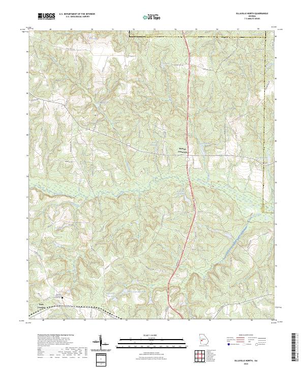
2024 Map of Ellaville North
USGS Topo · Published 2024About this map
Murrays Crossroads serves as a central point in this rural landscape within Schley County, where local roads converge near several historic water features. The map illustrates a region defined by its hydrography, featuring numerous family-named landmarks such as Hills Millpond, Walls Fish Pond, and Brays Mill Pond. These ponds and lakes, including the larger Lanceford Lake and American Legion Lake, suggest a long-standing reliance on the local creek systems, notably Buck Creek and Usry Creek, for recreation and agriculture.
Find a feature on this map
66 named features on this map. Tap any name to fly to it.
Don’t see what you’re looking for? This feature index may not catch every label — zoom into the map to look around manually.
Map Details
Editions of this 2024 Ellaville North Map
This is the sole edition of this map. No revisions or reprints were ever made.
Other maps of this area

1955 · Phenix City
USGS Topo · 1:250,000

1957 · Phenix City
USGS Topo · 1:250,000

1958 · Phenix City
USGS Topo · 1:250,000

1971 · Rupert
USGS Topo · 1:24,000

1971 · Ideal South
USGS Topo · 1:24,000

1971 · Ideal North
USGS Topo · 1:24,000

1971 · Ellaville North
USGS Topo · 1:24,000

1971 · Tazewell South
USGS Topo · 1:24,000
1971 · Tazewell North
USGS Topo · 1:24,000

1972 · Ellaville South
USGS Topo · 1:24,000