Loading...
Loading map...2023 Map of Ellendale
USGS Topo · Published 2023About this map
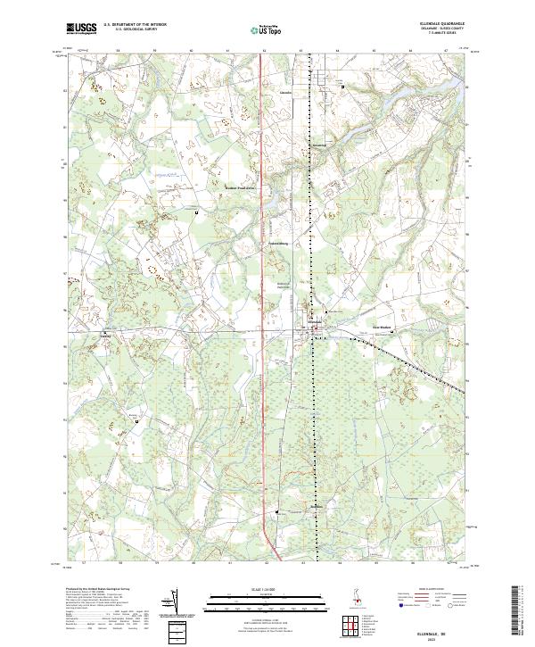
Ellendale serves as the central hub of this Sussex County landscape, situated at the junction where the Delmarva Peninsula terrain meets the expansive Ellendale Swamp. The map documents a dense network of local roads and watercourses that define the region's agricultural and residential character. Water features are prominent, ranging from the controlled waters of Clendaniel Pond and Hudson Pond to the natural flow of Cedar Creek and Gravelly Branch.
Find a feature on this map
110 named features on this map. Tap any name to fly to it.
Don’t see what you’re looking for? This feature index may not catch every label — zoom into the map to look around manually.
Map Details
Date Portrayed2023
Date Published2023
PublisherU.S. Geological Survey
Map TypeTopographic
Scale1:24000
Physical Dimensions24 x 29 inches
Editions of this 2023 Ellendale Map
This is the sole edition of this map. No revisions or reprints were ever made.
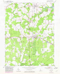
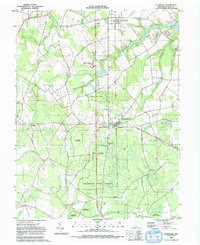
Historical Maps of Ellendale Through Time
3 maps found
Featured Locations
Source Details
SourceU.S. Geological Survey
CopyrightPublic Domain