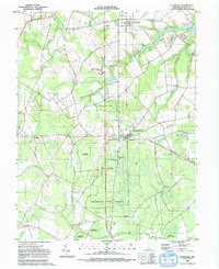
1992 Map of Ellendale
USGS Topo · Published 1992About this map
The Ellendale State Forest dominates this Sussex County landscape, preserving a network of wetlands and drainage patterns that defined the region's development. Centered on the town of Ellendale, the map reveals a community deeply rooted in its local institutions, evidenced by the numerous country churches like Mount Zion Ch and New Shiloh Ch. The hydrology of the area is intricate, with Beaver Dam Branch and Sowbridge Branch carving through the low-lying terrain toward various mill ponds. Genealogists can find significant detail in the placement of several burial grounds, including the Ellendale Cem and Faith Cem near Robbins. To the north, the transition from woodland to agriculture is marked by the presence of Clendaniel Pond and Cubbage Pond near the settlement of Lincoln.
Find a feature on this map
37 named features on this map. Tap any name to fly to it.
Don’t see what you’re looking for? This feature index may not catch every label — zoom into the map to look around manually.
Map Details
Editions of this 1992 Ellendale Map
This is the sole edition of this map. No revisions or reprints were ever made.
Other maps of this area

1915 · Seaford
USGS Topo · 1:62,500

1917 · Millsboro
USGS Topo · 1:62,500

1918 · Cedar Creek
USGS Topo · 1:62,500

1918 · Harrington
USGS Topo · 1:62,500

1919 · Cedar Creek
USGS Topo · 1:62,500

1938 · Cedar Creek
USGS Topo · 1:62,500

1938 · Millsboro
USGS Topo · 1:62,500
1944 · Milton
USGS Topo · 1:24,000

1944 · Cedar Creek
USGS Topo · 1:62,500

1944 · Millsboro
USGS Topo · 1:62,500