
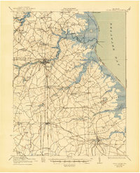
1938 Map of Cedar Creek
USGS Topo · Published 1938About this map
Milford serves as a central hub in this survey, where the P B And W RR intersects with a landscape defined by milling and coastal necks. The interior is densely dotted with rural schoolhouses, including the uniquely named Sour Apple Tree School, Shingle School, and Postles School, suggesting a highly distributed agrarian population. Along the Delaware Bay, the Mispillion River L H and various landings like Maloneys Landing indicate the vital maritime connection for these communities.
Find a feature on this map
83 named features on this map. Tap any name to fly to it.
Don’t see what you’re looking for? This feature index may not catch every label — zoom into the map to look around manually.
Map Details
Editions of this 1938 Cedar Creek Map
2 editions found
Other maps of this area

1890 · Maurice Cove
USGS Topo · 1:62,500

1891 · Maurice Cove
USGS Topo · 1:62,500

1899 · Vineland
USGS Topo · 1:125,000

1899 · Dover
USGS Topo · 1:125,000

1906 · Dover
USGS Topo · 1:125,000

1915 · Seaford
USGS Topo · 1:62,500

1917 · Millsboro
USGS Topo · 1:62,500

1918 · Cedar Creek
USGS Topo · 1:62,500

1918 · Harrington
USGS Topo · 1:62,500

1918 · Rehoboth
USGS Topo · 1:62,500