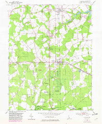
1954 Map of Ellendale
USGS Topo · Published 1982About this map
Ellendale State Forest dominates this Sussex County landscape, preserved as a patchwork of woodlands amid the drainage networks of the Ellendale Swamp. The town of Ellendale sits at the junction of the Dupont Highway and the east-west Conrail line, serving as a central hub for the surrounding rural communities of Lincoln, Oakley, and Robbins. The map documents a significant agricultural and forestry infrastructure, including the State Tree Nursery and several gravel pits, illustrating the local economy's reliance on the land's natural resources.
Find a feature on this map
30 named features on this map. Tap any name to fly to it.
Don’t see what you’re looking for? This feature index may not catch every label — zoom into the map to look around manually.
Map Details
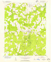
Editions of this 1954 Ellendale Map
2 editions found
Other maps of this area

1915 · Seaford
USGS Topo · 1:62,500

1917 · Millsboro
USGS Topo · 1:62,500

1918 · Cedar Creek
USGS Topo · 1:62,500

1918 · Harrington
USGS Topo · 1:62,500

1919 · Cedar Creek
USGS Topo · 1:62,500

1938 · Cedar Creek
USGS Topo · 1:62,500

1938 · Millsboro
USGS Topo · 1:62,500
1944 · Milton
USGS Topo · 1:24,000

1944 · Cedar Creek
USGS Topo · 1:62,500

1944 · Millsboro
USGS Topo · 1:62,500