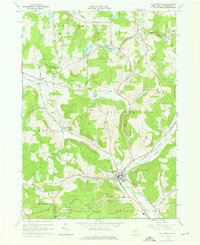
1964 Map of Ellicottville
USGS Topo · Published 1976About this map
Ellicottville serves as the focal point of this 1964 survey, situated at the confluence of several significant valleys and watercourses. The village and surrounding townships of East Otto, Mansfield, and Great Valley are depicted at a moment of transition where traditional timber and dairy landscapes began to integrate with a growing winter recreation economy. This shift is evident in the presence of the Holiday Valley Ski Club, Hollimont Ski Club, and Poverty Hill Ski Club, which carved trails into the steep slopes of the Great Valley Creek watershed.
Find a feature on this map
46 named features on this map. Tap any name to fly to it.
Don’t see what you’re looking for? This feature index may not catch every label — zoom into the map to look around manually.
Map Details
Editions of this 1964 Ellicottville Map
2 editions found
Other maps of this area

1900 · Salamanca
USGS Topo · 1:62,500

1922 · Randolph
USGS Topo · 1:62,500

1923 · Randolph
USGS Topo · 1:62,500

1923 · Cattaraugus
USGS Topo · 1:62,500

1924 · Ellicottville
USGS Topo · 1:62,500

1938 · Cattaraugus
USGS Topo · 1:62,500

1938 · Salamanca
USGS Topo · 1:62,500

1941 · Cattaraugus
USGS Topo · 1:62,500

1941 · Ellicottville
USGS Topo · 1:62,500

1943 · Randolph
USGS Topo · 1:62,500