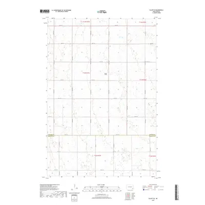
2018 Map of Elliott SE
USGS Topo · Published 2018About this map
The rolling plains of southeastern North Dakota are defined by a rhythmic section-line grid of rural roads and scattered wetlands. The boundary between Ransom Co and Sargent Co bisects the landscape, which is drained by the meandering Dead Colt Cr and the gentle depression of Timber Coulee. The terrain reveals a sparse settlement pattern characteristic of the region, where the Public Land Survey System has dictated the placement of nearly every thoroughfare, from 72nd St SE to 80th St SE. While no large towns are present on this specific sheet, the map provides a high-resolution view of the agricultural drainage and the many small prairie potholes that dot the townships.
Find a feature on this map
26 named features on this map. Tap any name to fly to it.
Don’t see what you’re looking for? This feature index may not catch every label — zoom into the map to look around manually.
Map Details
Editions of this 2018 Elliott SE Map
This is the sole edition of this map. No revisions or reprints were ever made.
Other maps of this area

1952 · Crete
USGS Topo · 1:24,000

1953 · Fargo
USGS Topo · 1:250,000

1956 · Fargo
USGS Topo · 1:250,000

1957 · Elliott SW
USGS Topo · 1:24,000

1957 · Stirum
USGS Topo · 1:24,000

1957 · Elliott SE
USGS Topo · 1:24,000
1962 · Englevale
USGS Topo · 1:24,000

1962 · Lisbon
USGS Topo · 1:24,000

1962 · Lisbon SW
USGS Topo · 1:24,000

1962 · Elliott
USGS Topo · 1:24,000
Featured Places
- Elliott Township, ND
- Vivian Township, ND
- Whitestone Hill Township, ND
- Island Park Township, ND
- Bale Township, ND