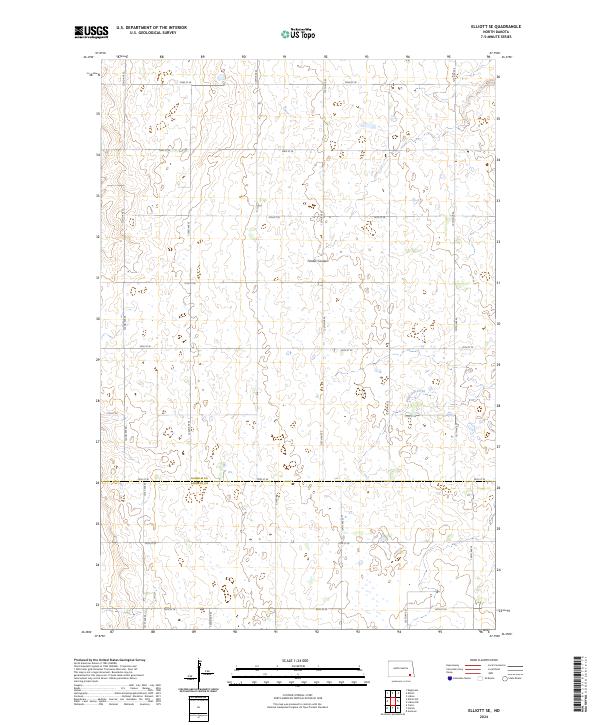
2024 Map of Elliott SE
USGS Topo · Published 2024About this map
The prairie landscape at the border of Ransom Co and Sargent Co is defined by a distinct network of seasonal watercourses and a rigid section-line grid. Two primary drainage features, Timber Coulee in the north and the winding Dead Colt Creek in the southeast, break the otherwise orderly township and range system. This rural corridor is etched with a precise infrastructure of gravel roads, including the north-south arterial Co Rd 4 and a series of numbered east-west routes from 72nd St SE to 80th St SE. The map provides a high-resolution view of the wetland pockets and topographic depressions typical of the region, revealing how modern agricultural access and natural hydrology coexist across this section of southeastern North Dakota.
Find a feature on this map
26 named features on this map. Tap any name to fly to it.
Don’t see what you’re looking for? This feature index may not catch every label — zoom into the map to look around manually.
Map Details
Editions of this 2024 Elliott SE Map
This is the sole edition of this map. No revisions or reprints were ever made.
Other maps of this area

1952 · Crete
USGS Topo · 1:24,000

1953 · Fargo
USGS Topo · 1:250,000

1956 · Fargo
USGS Topo · 1:250,000

1957 · Elliott SW
USGS Topo · 1:24,000

1957 · Stirum
USGS Topo · 1:24,000

1957 · Elliott SE
USGS Topo · 1:24,000
1962 · Englevale
USGS Topo · 1:24,000

1962 · Lisbon
USGS Topo · 1:24,000

1962 · Lisbon SW
USGS Topo · 1:24,000

1962 · Elliott
USGS Topo · 1:24,000
Featured Places
- Bale Township, ND
- Whitestone Hill Township, ND
- Island Park Township, ND
- Alleghany Township, ND
- Elliott Township, ND