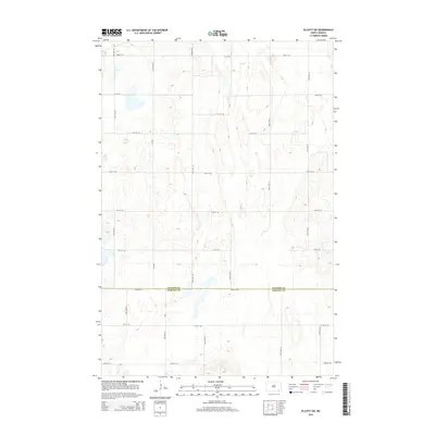
2014 Map of Elliott SW
USGS Topo · Published 2014About this map
The county line between Ransom Co and Sargent Co bisects this prairie landscape in the southeastern corner of North Dakota. In 2014, the region remains defined by a rigorous grid of section roads and rural routes, including Cr-3705 and Cr-3720, which navigate a terrain dotted with small seasonal wetlands and depressions. The map illustrates the persistent structure of agricultural land divisions, where major thoroughfares like 78th Ave SE provide the primary connectivity across the rolling plains. This document is particularly useful for researchers tracing modern property boundaries or land-use patterns along the border of these two counties, showing a landscape where the infrastructure of the rural west is etched into the earth through its strictly oriented road system, from 80th St SE in the south to the northern reaches of the quadrangle.
Find a feature on this map
14 named features on this map. Tap any name to fly to it.
Don’t see what you’re looking for? This feature index may not catch every label — zoom into the map to look around manually.
Map Details
Editions of this 2014 Elliott SW Map
This is the sole edition of this map. No revisions or reprints were ever made.
Other maps of this area

1894 · Oakes
USGS Topo · 1:62,500

1895 · Lamoure
USGS Topo · 1:125,000

1918 · La Moure
USGS Topo · 1:125,000

1952 · Oakes
USGS Topo · 1:24,000

1952 · Crete
USGS Topo · 1:24,000

1953 · Jamestown
USGS Topo · 1:250,000

1953 · Fargo
USGS Topo · 1:250,000

1956 · Fargo
USGS Topo · 1:250,000

1956 · Jamestown
USGS Topo · 1:250,000

1957 · Elliott SW
USGS Topo · 1:24,000