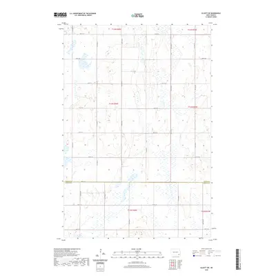
2020 Map of Elliott SW
USGS Topo · Published 2020About this map
Agricultural fields and prairie wetlands define the rural character of this region along the border of Ransom Co and Sargent Co in the late twentieth and early twenty-first centuries. The landscape is organized by a strict cardinal grid of gravel and section roads, including 118th Ave SE and 120th Ave SE, reflecting the legacy of the Public Land Survey System in North Dakota. This specific quadrangle covers portions of several townships, including t133n r58w and t134n r57w. Numerous small, un-named prairie potholes and marshy depressions are scattered throughout the sections, particularly visible near 74th St SE, illustrating the natural drainage patterns of the northern plains. While the map contains no major settlements, it provides a precise record of the road network and property boundaries essential for genealogical research and land-use history in this part of the state.
Find a feature on this map
24 named features on this map. Tap any name to fly to it.
Don’t see what you’re looking for? This feature index may not catch every label — zoom into the map to look around manually.
Map Details
Editions of this 2020 Elliott SW Map
This is the sole edition of this map. No revisions or reprints were ever made.
Other maps of this area

1894 · Oakes
USGS Topo · 1:62,500

1895 · Lamoure
USGS Topo · 1:125,000

1918 · La Moure
USGS Topo · 1:125,000

1952 · Oakes
USGS Topo · 1:24,000

1952 · Crete
USGS Topo · 1:24,000

1953 · Jamestown
USGS Topo · 1:250,000

1953 · Fargo
USGS Topo · 1:250,000

1956 · Fargo
USGS Topo · 1:250,000

1956 · Jamestown
USGS Topo · 1:250,000

1957 · Elliott SW
USGS Topo · 1:24,000