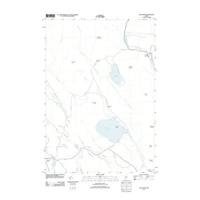
2011 Map of Ellis Pond
USGS Topo · Published 2011About this map
Ellis Pond and its neighbor Little Ellis Pond form the geographic center of this Maine landscape, where the waters of the Ellis River and Swift River drain the surrounding peaks. The topography is defined by significant elevations such as Pleasant Mountain and Old Turk Mountain, while French Island sits prominently within the larger pond. Early 21st-century settlement patterns are concentrated in the villages of Andover and Byron, with recreational and access routes like Shore Dr and Roxbury Pond Rd skirting the water. For local history, the map preserves the locations of the Stockbridge Cemetery, West Byron Cemetery, and Andover Cemetery. Natural landmarks like Coos Canyon and Silver Ripple Cascade highlight the area's sharp relief, while a network of fire lanes suggests the managed timber and wilderness access of the Oxford County interior.
Find a feature on this map
63 named features on this map. Tap any name to fly to it.
Don’t see what you’re looking for? This feature index may not catch every label — zoom into the map to look around manually.
Map Details
Editions of this 2011 Ellis Pond Map
This is the sole edition of this map. No revisions or reprints were ever made.
Other maps of this area

1927 · Rumford
USGS Topo · 1:48,000

1930 · Rumford
USGS Topo · 1:62,500

1933 · Rangeley
USGS Topo · 1:48,000

1939 · Rangeley
USGS Topo · 1:62,500

1940 · Oquossoc
USGS Topo · 1:62,500

1942 · Oquossoc
USGS Topo · 1:62,500

1943 · Old Speck Mtn
USGS Topo · 1:62,500

1945 · Old Speck Mtn
USGS Topo · 1:62,500

1949 · Rangeley
USGS Topo · 1:62,500

1950 · Lewiston
USGS Topo · 1:250,000