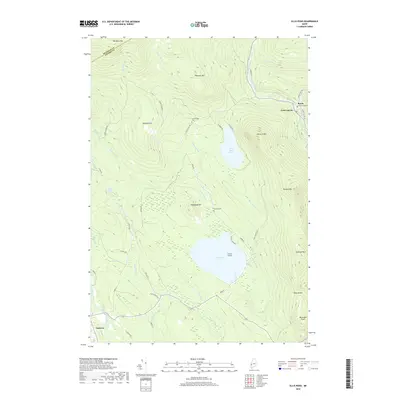
2018 Map of Ellis Pond
USGS Topo · Published 2018About this map
Andover and Byron flank a high-elevation landscape defined by the expansive Ellis Pond and its smaller neighbor, Little Ellis Pond. The terrain is marked by prominent peaks such as Old Blue Mtn, Pleasant Mtn, and Record Hill, which rise above the drainages of the Ellis River and the Swift River. Water features are central to this area's character, including the Silver Ripple Cascade, Ellis Falls, and the narrow Coos Canyon near the village of Byron.
Find a feature on this map
55 named features on this map. Tap any name to fly to it.
Don’t see what you’re looking for? This feature index may not catch every label — zoom into the map to look around manually.
Map Details
Editions of this 2018 Ellis Pond Map
This is the sole edition of this map. No revisions or reprints were ever made.
Other maps of this area

1927 · Rumford
USGS Topo · 1:48,000

1930 · Rumford
USGS Topo · 1:62,500

1933 · Rangeley
USGS Topo · 1:48,000

1939 · Rangeley
USGS Topo · 1:62,500

1940 · Oquossoc
USGS Topo · 1:62,500

1942 · Oquossoc
USGS Topo · 1:62,500

1943 · Old Speck Mtn
USGS Topo · 1:62,500

1945 · Old Speck Mtn
USGS Topo · 1:62,500

1949 · Rangeley
USGS Topo · 1:62,500

1950 · Lewiston
USGS Topo · 1:250,000