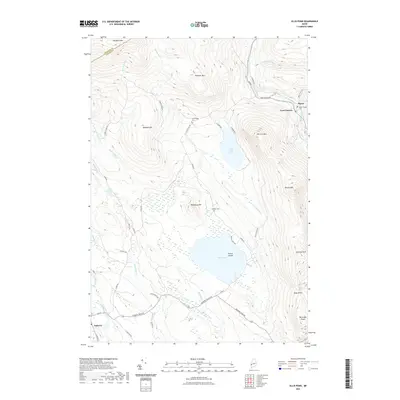
2021 Map of Ellis Pond
USGS Topo · Published 2021About this map
Andover and the settlement of Byron anchor the high-elevation terrain of Oxford County, where the Ellis River and Swift River drainage systems define the local geography. The area's mid-century character is preserved through numerous family and local landmarks, including the Byron Village Cem, Stockbridge Cem, and Pressey Cem, which provide essential points of reference for genealogists. The landscape is dominated by significant peaks such as Old Turk Mtn, Pleasant Mtn, and Record Hill, while the massive basin of Ellis Pond contains French Island at its center. This topographic record highlights a region defined by water and woods, from the steep walls of Coos Canyon to the falls at Silver Ripple Cascade and Ellis Falls. Small local roads like Lowness Farm Rd and Easter Hill Rd cut through the timberland, connecting isolated homesteads and high-country gaps like Mine Notch.
Find a feature on this map
54 named features on this map. Tap any name to fly to it.
Don’t see what you’re looking for? This feature index may not catch every label — zoom into the map to look around manually.
Map Details
Editions of this 2021 Ellis Pond Map
This is the sole edition of this map. No revisions or reprints were ever made.
Other maps of this area

1927 · Rumford
USGS Topo · 1:48,000

1930 · Rumford
USGS Topo · 1:62,500

1933 · Rangeley
USGS Topo · 1:48,000

1939 · Rangeley
USGS Topo · 1:62,500

1940 · Oquossoc
USGS Topo · 1:62,500

1942 · Oquossoc
USGS Topo · 1:62,500

1943 · Old Speck Mtn
USGS Topo · 1:62,500

1945 · Old Speck Mtn
USGS Topo · 1:62,500

1949 · Rangeley
USGS Topo · 1:62,500

1950 · Lewiston
USGS Topo · 1:250,000