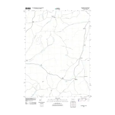
2010 Map of Ellisburg
USGS Topo · Published 2010About this map
Oswayo Creek and its various tributaries, including Hemlock Hollow Run and Peet Brook, define the drainage of this Pennsylvania-New York borderland. The landscape is characterized by a series of high ridges and hollows, such as McGinnis Hollow, Leadville Hollow, and Kenyon Hollow, which dictate the placement of the rural road network. Small, historic clusters of settlement are found at crossroads and valley junctions, most notably Ellisburg, Andrews Settlement, and Reynoldstown. Near the southern edge of the map, Rose Lake sits at the base of the hills, while named high points like Carmer Hill and Ford Hill rise above the surrounding valleys. The road system, including routes like Cemetery Rd and Pump Station Rd, reflects a history of local land use tied to the topography of the Twin Tiers region.
Find a feature on this map
53 named features on this map. Tap any name to fly to it.
Don’t see what you’re looking for? This feature index may not catch every label — zoom into the map to look around manually.
Map Details
Editions of this 2010 Ellisburg Map
This is the sole edition of this map. No revisions or reprints were ever made.
Other maps of this area

1925 · Belmont
USGS Topo · 1:62,500

1926 · Wellsville
USGS Topo · 1:62,500

1932 · Genesee
USGS Topo · 1:62,500

1934 · Coudersport
USGS Topo · 1:48,000

1937 · Genesee
USGS Topo · 1:62,500

1938 · Coudersport
USGS Topo · 1:62,500

1939 · Belmont
USGS Topo · 1:62,500

1950 · Elmira
USGS Topo · 1:250,000

1954 · Williamsport
USGS Topo · 1:250,000

1957 · Warren
USGS Topo · 1:250,000