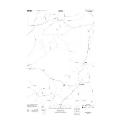
2013 Map of Ellisburg
USGS Topo · Published 2013About this map
Oswayo Cr carves through this northern Pennsylvania and southern New York borderland, anchoring a network of small upland settlements. The village of Ellisburg serves as a central hub for the surrounding rural landscape, which is defined by numerous named hollows such as Leadville Hollow and Nelson Hollow. These deep valleys indicate a long history of timber and agricultural use, with narrow roads tracing the bottomlands. To the south, Andrews Settlement and Reynoldstown occupy more open terrain near Rose Lake, while the local aviation history is marked by Greeley Airport near Ford Hill. The map detail captures the intersection of natural watercourses like Hemlock Hollow Run and Peet Brook with the local transport network, illustrating how the topography influenced the development of these isolated communities in both Allegany and Potter counties.
Find a feature on this map
69 named features on this map. Tap any name to fly to it.
Don’t see what you’re looking for? This feature index may not catch every label — zoom into the map to look around manually.
Map Details
Editions of this 2013 Ellisburg Map
This is the sole edition of this map. No revisions or reprints were ever made.
Other maps of this area

1925 · Belmont
USGS Topo · 1:62,500

1926 · Wellsville
USGS Topo · 1:62,500

1932 · Genesee
USGS Topo · 1:62,500

1934 · Coudersport
USGS Topo · 1:48,000

1937 · Genesee
USGS Topo · 1:62,500

1938 · Coudersport
USGS Topo · 1:62,500

1939 · Belmont
USGS Topo · 1:62,500

1950 · Elmira
USGS Topo · 1:250,000

1954 · Williamsport
USGS Topo · 1:250,000

1957 · Warren
USGS Topo · 1:250,000