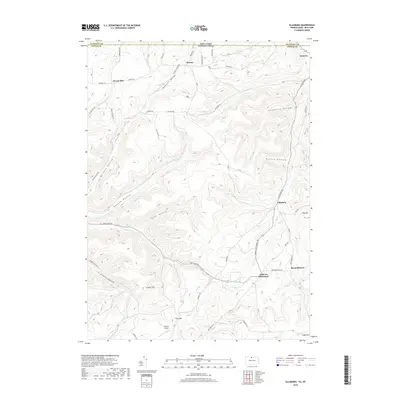
2019 Map of Ellisburg
USGS Topo · Published 2019About this map
The high plateaus of the Pennsylvania-New York border define this landscape, where small crossroads communities like Ellisburg and Andrews Settlement are linked by a network of hollows and ridge-top roads. In this rural pocket of Potter and Allegany counties, the headwaters of Oswayo Cr and Elevenmile Cr carve deep valleys through the terrain. The map captures the distinct settlement pattern of the region, where family names are etched into the geography at places like McGinnis Hollow, Brizzee Hollow, and Nelson Hollow.
Find a feature on this map
70 named features on this map. Tap any name to fly to it.
Don’t see what you’re looking for? This feature index may not catch every label — zoom into the map to look around manually.
Map Details
Editions of this 2019 Ellisburg Map
This is the sole edition of this map. No revisions or reprints were ever made.
Other maps of this area

1925 · Belmont
USGS Topo · 1:62,500

1926 · Wellsville
USGS Topo · 1:62,500

1932 · Genesee
USGS Topo · 1:62,500

1934 · Coudersport
USGS Topo · 1:48,000

1937 · Genesee
USGS Topo · 1:62,500

1938 · Coudersport
USGS Topo · 1:62,500

1939 · Belmont
USGS Topo · 1:62,500

1950 · Elmira
USGS Topo · 1:250,000

1954 · Williamsport
USGS Topo · 1:250,000

1957 · Warren
USGS Topo · 1:250,000