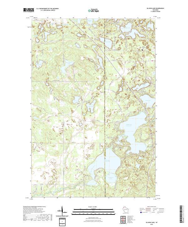
2022 Map of Ellison Lake
USGS Topo · Published 2022About this map
Lower Eau Claire Lake and Middle Eau Claire Lake dominate this northern Wisconsin landscape, linked by the Eau Claire River as it flows through the glacial terrain of Douglas and Bayfield counties. The map captures a region defined by its dense concentration of water bodies, ranging from the large Ellison Lake to smaller basins like Cranberry Lake and Mimi Lake. For genealogists and local historians, the Barnes Memorial Cem near the northeastern corner serves as a significant landmark of the local community.
Find a feature on this map
102 named features on this map. Tap any name to fly to it.
Don’t see what you’re looking for? This feature index may not catch every label — zoom into the map to look around manually.
Map Details
Editions of this 2022 Ellison Lake Map
This is the sole edition of this map. No revisions or reprints were ever made.
Other maps of this area

1944 · Drummond
USGS Topo · 1:48,000

1944 · Hayward
USGS Topo · 1:48,000

1945 · Highland
USGS Topo · 1:48,000

1947 · Drummond
USGS Topo · 1:48,000

1947 · Chittamo
USGS Topo · 1:48,000

1949 · Chittamo
USGS Topo · 1:48,000

1949 · Highland
USGS Topo · 1:48,000

1953 · Ashland
USGS Topo · 1:250,000

1958 · Ashland
USGS Topo · 1:250,000
1961 · Ellison Lake
USGS Topo · 1:62,500