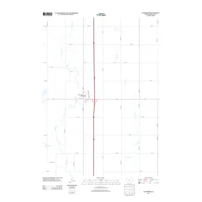
2013 Map of Ellsworth
USGS Topo · Published 2013About this map
Ellsworth serves as the central hub of this Hamilton County landscape, situated at the intersection of local routes and modern infrastructure. The town's grid is defined by streets such as Central Ave, Thoreson Ave, and Dewitt St, reflecting a well-established prairie settlement pattern. To the west, the S Skunk River meanders through the countryside, while Goose Lake and Ditch Number 71 illustrate the local hydrography and the legacy of agricultural drainage common in this region of Iowa. The surrounding area remains largely agrarian, divided by a systematic network of section-line roads like Vail Ave and 300th St. In the eastern portion of the quadrangle, Long Dick Cr winds through the fields, highlighting the natural drainage systems that define the rural character of the terrain between larger settlements.
Find a feature on this map
29 named features on this map. Tap any name to fly to it.
Don’t see what you’re looking for? This feature index may not catch every label — zoom into the map to look around manually.
Map Details
Editions of this 2013 Ellsworth Map
This is the sole edition of this map. No revisions or reprints were ever made.
Other maps of this area

1912 · Ames
USGS Topo · 1:62,500

1914 · Ames
USGS Topo · 1:62,500

1954 · Waterloo
USGS Topo · 1:250,000

1955 · Waterloo
USGS Topo · 1:250,000

1975 · Ames NW
USGS Topo · 1:24,000

1975 · Story City
USGS Topo · 1:24,000

1975 · Mc Callsburg
USGS Topo · 1:24,000

1978 · Blairsburg
USGS Topo · 1:24,000

1978 · Ellsworth
USGS Topo · 1:24,000

1978 · Jewell
USGS Topo · 1:24,000