
1981 Map of Ellsworth
USGS Topo · Published 1982About this map
The Union River serves as the central artery for this coastal Maine region, connecting the industrial infrastructure at Graham Dam through Leonard Lake to the city center of Ellsworth. The map illustrates a landscape shaped by both natural waterways and human industry, featuring numerous gravel pits and the Maine Central RR line that corridors through the town. Institutional presence is notable with the Green Lake National Fish Hatchery at the north and the Maine Coast Mem Hospital near the urban core.
Find a feature on this map
69 named features on this map. Tap any name to fly to it.
Don’t see what you’re looking for? This feature index may not catch every label — zoom into the map to look around manually.
Map Details
Editions of this 1981 Ellsworth Map
This is the sole edition of this map. No revisions or reprints were ever made.
Other maps of this area

1900 · Orland
USGS Topo · 1:62,500

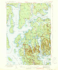
1904 · Mount Desert
USGS Topo · 1:62,500

1904 · Bluehill
USGS Topo · 1:62,500

1905 · Penobscot Bay
USGS Topo · 1:125,000

1911 · Ellsworth
USGS Topo · 1:62,500
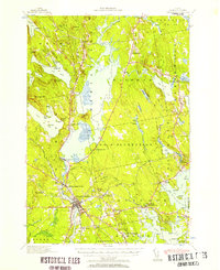
1940 · Ellsworth
USGS Topo · 1:62,500

1942 · Orland
USGS Topo · 1:62,500
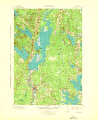
1942 · Ellsworth
USGS Topo · 1:62,500
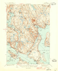
1942 · Mount Desert
USGS Topo · 1:62,500
1944 · Blue Hill
USGS Topo · 1:62,500