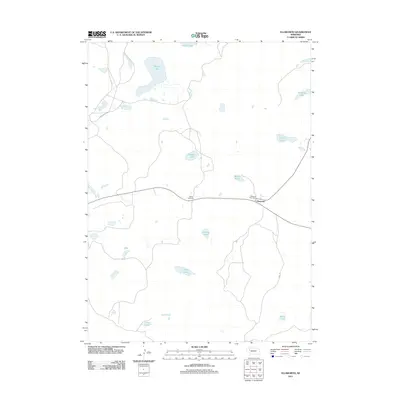
2011 Map of Ellsworth
USGS Topo · Published 2011About this map
Ellsworth and West Ellsworth form the primary human footprint in this corner of the Nebraska Sandhills. The landscape is defined by its numerous shallow water bodies, characteristic of this semi-arid region, including Black Lake, Shubert Lake, and Merritt Lake. These lakes often serve as vital watering holes in the ranching country, linked by a sparse network of roads such as Starr Ranch Rd. The Ellsworth Post Office remains a central landmark for the local community. The distribution of these features reveals a settlement pattern dictated by the placement of water and the long-established ranching operations that define Sheridan County. This 2011 survey captures the area before modern shifts in agricultural land use, providing a baseline for researchers tracking the hydrological and demographic changes in western Nebraska.
Find a feature on this map
15 named features on this map. Tap any name to fly to it.
Don’t see what you’re looking for? This feature index may not catch every label — zoom into the map to look around manually.
Map Details
Editions of this 2011 Ellsworth Map
This is the sole edition of this map. No revisions or reprints were ever made.
Other maps of this area

1948 · Bingham
USGS Topo · 1:62,500

1948 · Lakeside
USGS Topo · 1:62,500

1949 · Mumper
USGS Topo · 1:62,500

1950 · Longfellow Lake
USGS Topo · 1:62,500

1950 · Lakeside
USGS Topo · 1:62,500

1950 · Bingham
USGS Topo · 1:62,500

1954 · Scottsbluff
USGS Topo · 1:250,000

1955 · Alliance
USGS Topo · 1:250,000

1957 · Alliance
USGS Topo · 1:250,000

1958 · Alliance
USGS Topo · 1:250,000