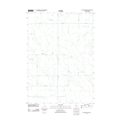
2012 Map of Elm Creek Ranch
USGS Topo · Published 2012About this map
Elm Creek Ranch serves as the focal point for this Pennington County landscape, where the high plains of South Dakota are defined by a network of drainage creeks and ranching infrastructure. The terrain rises to distinct elevations at Hubbard Hill and Bliss Hill, while a sparse grid of rural roads like Big Foote Rd and Kelly Hill Rd connects isolated homesteads and livestock operations. The local economy and transportation are further evidenced by private aviation facilities, including the Clark Landing Strip in the north and the Hoffman Landing Strip to the west. Water sources are critical in this environment, with the winding paths of Elm Cr, Poeno Cr, and Lake Cr providing the essential hydrology for the surrounding grazing lands and the ranch at the center of the survey.
Find a feature on this map
17 named features on this map. Tap any name to fly to it.
Don’t see what you’re looking for? This feature index may not catch every label — zoom into the map to look around manually.
Map Details
Editions of this 2012 Elm Creek Ranch Map
This is the sole edition of this map. No revisions or reprints were ever made.
Other maps of this area

1953 · Rapid City
USGS Topo · 1:250,000

1954 · Pierre
USGS Topo · 1:250,000

1955 · Hot Springs
USGS Topo · 1:250,000

1955 · Martin
USGS Topo · 1:250,000

1957 · Rapid City
USGS Topo · 1:250,000

1958 · Pierre
USGS Topo · 1:250,000

1958 · Martin
USGS Topo · 1:250,000
1960 · Wall
USGS Topo · 1:24,000
1961 · Cottonwood
USGS Topo · 1:24,000
1961 · Wall NE
USGS Topo · 1:24,000