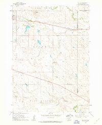
1961 Map of Wall NE
USGS Topo · Published 1963About this map
Quinn serves as the primary settlement on this western South Dakota landscape, situated along the line of the Chicago and North Western railroad. The topography is defined by prominent high points like Quinn Butte and Street Hill, which overlook a network of seasonal drainages including Cottonwood Creek and Whitewater Creek. Small-scale industrial activity is evident at the Quarries north of town, while the local civic infrastructure is represented by the Cottonwood Sch and Mt Hope Cem. The presence of the Tennyson Dam creating a small reservoir near the railroad line suggests the critical importance of water management in this semi-arid region. This 1961 field-checked survey also captures the junction of three counties — Pennington, Haakon, and Jackson — underscoring the area's role as a geographic crossroads for the surrounding ranching and rail-dependent communities.
Find a feature on this map
22 named features on this map. Tap any name to fly to it.
Don’t see what you’re looking for? This feature index may not catch every label — zoom into the map to look around manually.
Map Details
Editions of this 1961 Wall NE Map
2 editions found
Other maps of this area

1953 · Rapid City
USGS Topo · 1:250,000

1954 · Pierre
USGS Topo · 1:250,000

1955 · Hot Springs
USGS Topo · 1:250,000

1955 · Martin
USGS Topo · 1:250,000

1957 · Rapid City
USGS Topo · 1:250,000

1958 · Pierre
USGS Topo · 1:250,000

1958 · Martin
USGS Topo · 1:250,000

1960 · Wall SE
USGS Topo · 1:24,000

1960 · Wall
USGS Topo · 1:24,000

1960 · Cottonwood SW
USGS Topo · 1:24,000