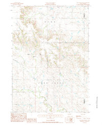
1983 Map of Elm Creek Ranch
USGS Topo · Published 1984About this map
Elm Creek Ranch sits at the heart of this Pennington and Haakon County borderland, where the open landscape is defined by the winding course of Lake Creek and its southern tributaries. The map documents a sparsely settled ranching region in the early 1980s, punctuated by family-named terrain like Hubbard Hill and Bliss Hill. The reliance on local aviation in this remote territory is evident from the inclusion of the Clark Landing Strip and the Hoffman Landing Strip, which provided essential access to these isolated properties. Drainages such as Poeno Creek and Lost Draw cut through the high plains, illustrating the complex natural irrigation and erosion patterns that shaped South Dakota's livestock industry during this era.
Find a feature on this map
12 named features on this map. Tap any name to fly to it.
Don’t see what you’re looking for? This feature index may not catch every label — zoom into the map to look around manually.
Map Details
Editions of this 1983 Elm Creek Ranch Map
This is the sole edition of this map. No revisions or reprints were ever made.
Other maps of this area

1953 · Rapid City
USGS Topo · 1:250,000

1954 · Pierre
USGS Topo · 1:250,000

1955 · Hot Springs
USGS Topo · 1:250,000

1955 · Martin
USGS Topo · 1:250,000

1957 · Rapid City
USGS Topo · 1:250,000

1958 · Pierre
USGS Topo · 1:250,000

1958 · Martin
USGS Topo · 1:250,000

1960 · Wall
USGS Topo · 1:24,000

1961 · Cottonwood
USGS Topo · 1:24,000
1961 · Wall NE
USGS Topo · 1:24,000