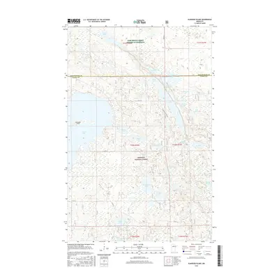
2016 Map of Elmwood Island
USGS Topo · Published 2016About this map
Chippewa National Forest dominates this northern Minnesota landscape, where the boundary between Koochiching and Itasca counties cuts through a complex network of glacial lakes and wetlands. The central terrain is defined by substantial water bodies like Island Lake and Moose Lake, with Elmwood Island forming a prominent landmark within the western waters. Small-scale infrastructure such as Moose Lake Resort Rd and Co Rd 159 provides access to these remote reaches, which are managed for conservation and recreation. The mapping of the Welch Lake Impoundment and the Eel Lake Impoundment indicates a landscape modified for water level management, supporting the diverse ecosystems found at the Wildlife Marsh and along Moose Brook.
Find a feature on this map
36 named features on this map. Tap any name to fly to it.
Don’t see what you’re looking for? This feature index may not catch every label — zoom into the map to look around manually.
Map Details
Editions of this 2016 Elmwood Island Map
This is the sole edition of this map. No revisions or reprints were ever made.
Other maps of this area

1919 · Rosy
USGS Topo · 1:62,500

1919 · Gemmell
USGS Topo · 1:62,500

1919 · Max
USGS Topo · 1:62,500

1919 · Bridgie
USGS Topo · 1:62,500

1924 · Bridgie
USGS Topo · 1:62,500

1954 · Bemidji
USGS Topo · 1:250,000

1957 · Bemidji
USGS Topo · 1:250,000

1958 · Bemidji
USGS Topo · 1:250,000

1971 · Squaw Lake
USGS Topo · 1:24,000
1971 · Dora Lake
USGS Topo · 1:24,000