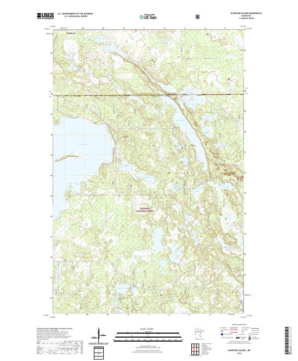
2022 Map of Elmwood Island
USGS Topo · Published 2022About this map
Northome sits at the northern edge of this Northwoods landscape, where the boundary between Koochiching and Itasca counties meets the extensive reaches of the Chippewa National Forest. The area is defined by a complex mosaic of glacial lakes and wetlands, including the prominent Island Lake which contains its namesake Elmwood Island. A network of rural routes like Co Rd 174 and Benders Rd provides access to the shoreline developments and recreational sites that dot the waterfronts.
Find a feature on this map
35 named features on this map. Tap any name to fly to it.
Don’t see what you’re looking for? This feature index may not catch every label — zoom into the map to look around manually.
Map Details
Editions of this 2022 Elmwood Island Map
This is the sole edition of this map. No revisions or reprints were ever made.
Other maps of this area

1919 · Rosy
USGS Topo · 1:62,500

1919 · Gemmell
USGS Topo · 1:62,500

1919 · Max
USGS Topo · 1:62,500

1919 · Bridgie
USGS Topo · 1:62,500

1924 · Bridgie
USGS Topo · 1:62,500

1954 · Bemidji
USGS Topo · 1:250,000

1957 · Bemidji
USGS Topo · 1:250,000

1958 · Bemidji
USGS Topo · 1:250,000

1971 · Squaw Lake
USGS Topo · 1:24,000
1971 · Dora Lake
USGS Topo · 1:24,000