Loading...
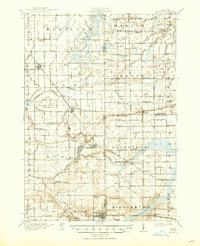
Loading map...1918 Map of Elsie
USGS Topo · Published 1950About this map
The Maple River winds through this agricultural landscape at the meeting point of Gratiot, Clinton, Saginaw, and Shiawassee counties. Surveyed in the mid-1910s, the map reveals a dense network of country schools, including the Elba Center School, Stafford School, and Limbocker School. The Ann Arbor Railroad serves as a primary transit corridor, connecting the settlements of Ashley, Bannister, Elsie, and Carland.
Find a feature on this map
106 named features on this map. Tap any name to fly to it.
Don’t see what you’re looking for? This feature index may not catch every label — zoom into the map to look around manually.
Map Details
Date Portrayed1918
Date Published1950
PublisherU.S. Geological Survey
Map TypeTopographic
Scale1:62,500
Physical Dimensions16.9 x 20.8 inches
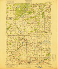
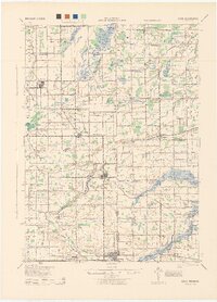
Editions of this 1918 Elsie Map
3 editions found

Historical Maps of Ovid Through Time
Featured Locations
- Ashley, Elba Township
- Chapin, Chapin Township
- Duplain, Duplain Township
- Elsie, Duplain Township
- Ovid, Ovid Township
Source Details
SourceU.S. Geological Survey
CopyrightPublic Domain