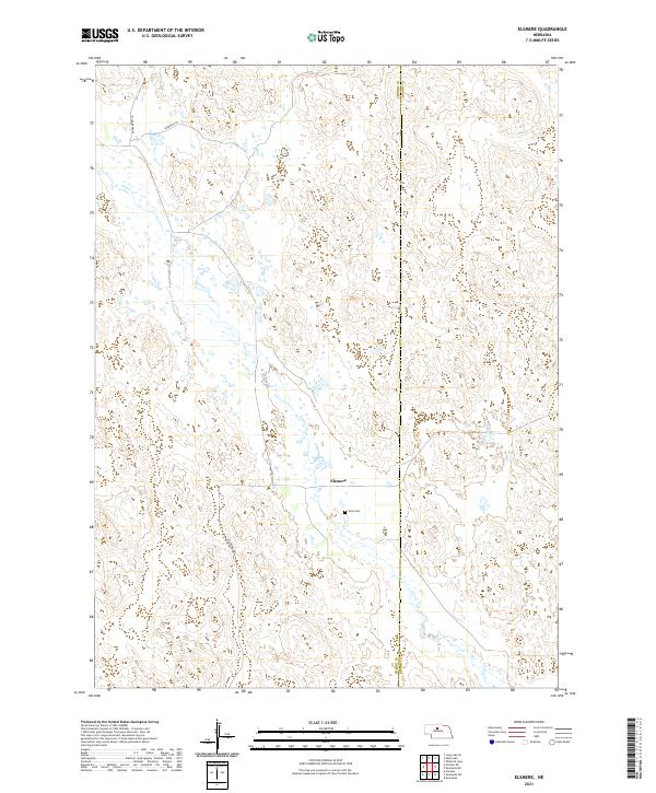
2021 Map of Elsmere
USGS Topo · Published 2021About this map
Elsmere serves as the focal point for this rural section of the Sandhills, situated along the county line where Cherry Co Brown Co meet. The landscape is defined by the winding course of Goose Cr, which carves through the undulating terrain of the central Nebraska plains. Local history and genealogy are anchored at Giles Cem, a quiet landmark south of the main settlement. The area's road network, including Sandcherry Ln, Sandreed Ln, and Elsmere Ave, reflects the region's ranching heritage and the practical infrastructure required to connect isolated homesteads across the vast township divisions of t26n r25w and t25n r25w.
Find a feature on this map
11 named features on this map. Tap any name to fly to it.
Don’t see what you’re looking for? This feature index may not catch every label — zoom into the map to look around manually.
Map Details
Editions of this 2021 Elsmere Map
This is the sole edition of this map. No revisions or reprints were ever made.
Other maps of this area

1949 · Purdum
USGS Topo · 1:62,500

1949 · Koshopah
USGS Topo · 1:62,500

1949 · Long Lake
USGS Topo · 1:62,500

1951 · Long Lake
USGS Topo · 1:62,500

1951 · Purdum
USGS Topo · 1:62,500

1951 · Moon Lake
USGS Topo · 1:62,500

1951 · Koshopah
USGS Topo · 1:62,500

1957 · Valentine
USGS Topo · 1:250,000

1959 · Valentine
USGS Topo · 1:250,000
1985 · Long Lake SE
USGS Topo · 1:24,000