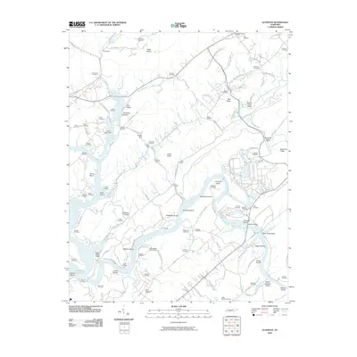
2010 Map of Elverton
USGS Topo · Published 2010About this map
The Little Emory River and its complex network of shoals define this pocket of eastern Tennessee, where the landscape transitions from the heights of Dickey Ridge and McKinney Ridge down to the water's edge. This 2010 topographic record captures the area's deep genealogical layers, evidenced by an exceptional density of family and community burial grounds including the Slave Cemetery, the Pauper Cemetery, and the Poor Farm Cemetery. These sites, alongside numerous family-named plots like the Massengil Spring Cemetery and Ollis Cemetery, provide a critical spatial index for local historians and family researchers.
Find a feature on this map
128 named features on this map. Tap any name to fly to it.
Don’t see what you’re looking for? This feature index may not catch every label — zoom into the map to look around manually.
Map Details
Editions of this 2010 Elverton Map
This is the sole edition of this map. No revisions or reprints were ever made.
Other maps of this area

1887 · Kingston
USGS Topo · 1:125,000

1891 · Kingston
USGS Topo · 1:125,000

1893 · Briceville
USGS Topo · 1:125,000

1893 · Kingston
USGS Topo · 1:125,000

1895 · Wartburg
USGS Topo · 1:125,000

1895 · Loudon
USGS Topo · 1:125,000

1895 · Briceville
USGS Topo · 1:125,000

1896 · Wartburg
USGS Topo · 1:125,000

1896 · Briceville
USGS Topo · 1:125,000

1935 · Camp Austin
USGS Topo · 1:24,000