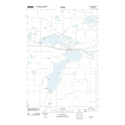
2010 Map of Elysian
USGS Topo · Published 2010About this map
The town of Elysian serves as a central hub in this lake-heavy landscape, situated on a narrow strip of land between Lake Francis and the northern reaches of Lake Elysian. The area's complex glacial geography is defined by numerous water bodies, including Tetonka Lake, Lakeview Lake, and the now-dry Dove Lakebed. Settlement patterns follow the contours of these lakes, with family history preserved in the scattered Dehn Family Cemetery, Okaman Cemetery, and Greenland Cemetery near the community of Greenland. Notable landmarks like the Elysian Lake Dam and Galfers Airport sit alongside the Sakatah Singing Hills Trl, a recreational route that traverses the region’s wooded lake country. The map captures a moment of modern land use where recreational sites like Prairie Ridge Golf Course coexist with rural infrastructure.
Find a feature on this map
79 named features on this map. Tap any name to fly to it.
Don’t see what you’re looking for? This feature index may not catch every label — zoom into the map to look around manually.
Map Details
Editions of this 2010 Elysian Map
This is the sole edition of this map. No revisions or reprints were ever made.
Other maps of this area

1950 · Mankato East
USGS Topo · 1:62,500

1951 · Mankato East
USGS Topo · 1:62,500

1953 · Saint Paul
USGS Topo · 1:250,000

1959 · Saint Paul
USGS Topo · 1:250,000

1965 · Cleveland
USGS Topo · 1:24,000

1966 · Waseca
USGS Topo · 1:24,000

1966 · Janesville
USGS Topo · 1:24,000

1966 · Waterville
USGS Topo · 1:24,000

1966 · Cordova
USGS Topo · 1:24,000

1966 · Elysian
USGS Topo · 1:24,000